|
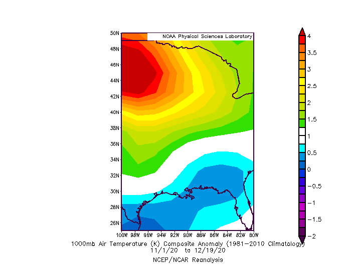
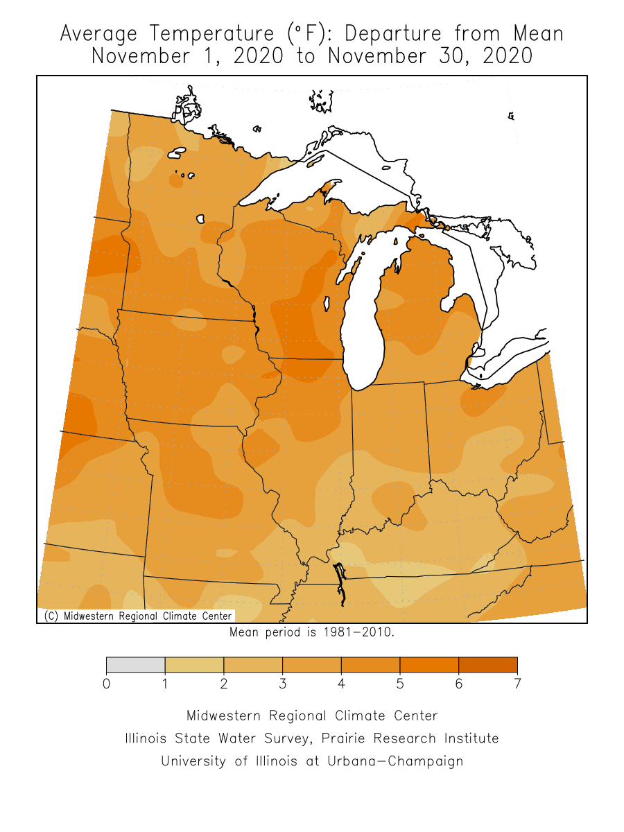
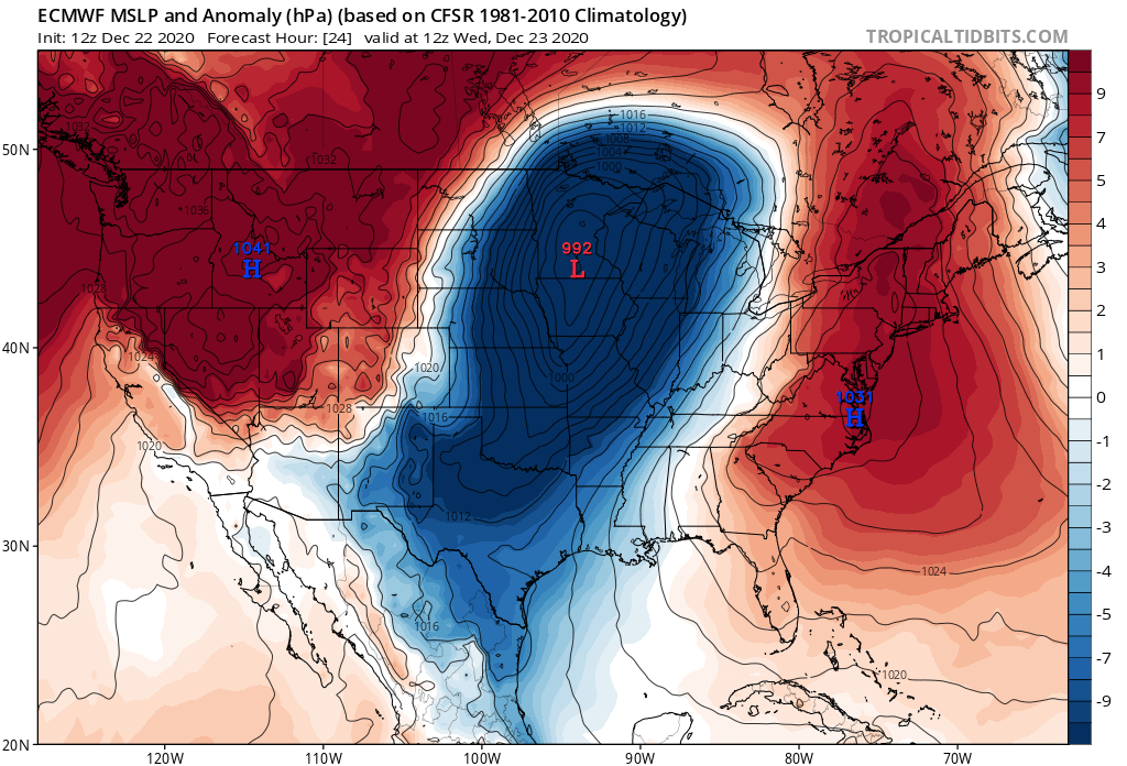
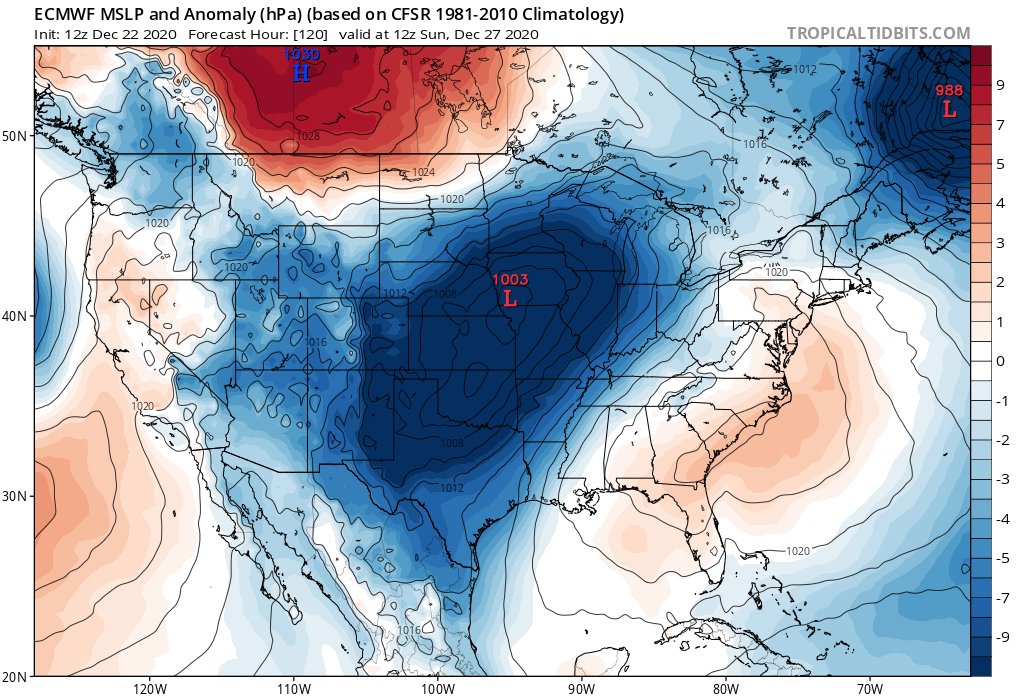
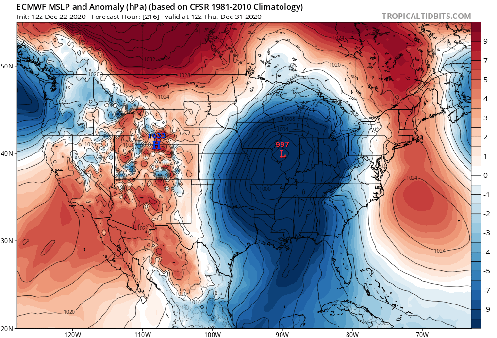
Preface: I wrote most of this blog on the 21st of December but was busy and wasn't able to publish until late on the 23rd so some timing and model runs might be off. That being said the general picture will remain the same on all the points and facts I listed below. So far this winter, much of the Midwest and more specifically Chicago, has gotten very little snowfall. Many locations in the vicinity of the Great Lakes are running at 10-25% of the usual snowfall up to December 20th with temperatures also running much warmer than normal. In this blog I'll be looking at what has caused so little snow to fall, as well as, if any relief is possible for snow lovers in the coming weeks. Winter so far: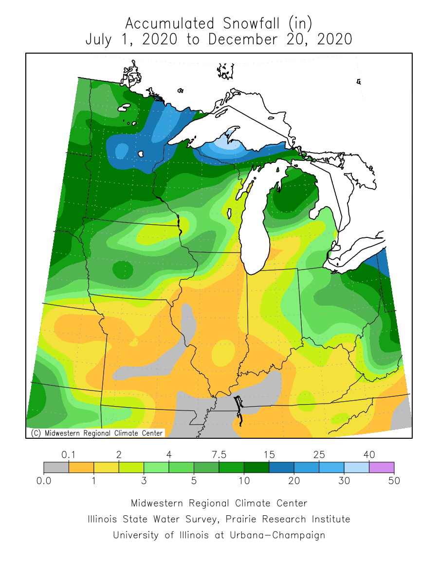 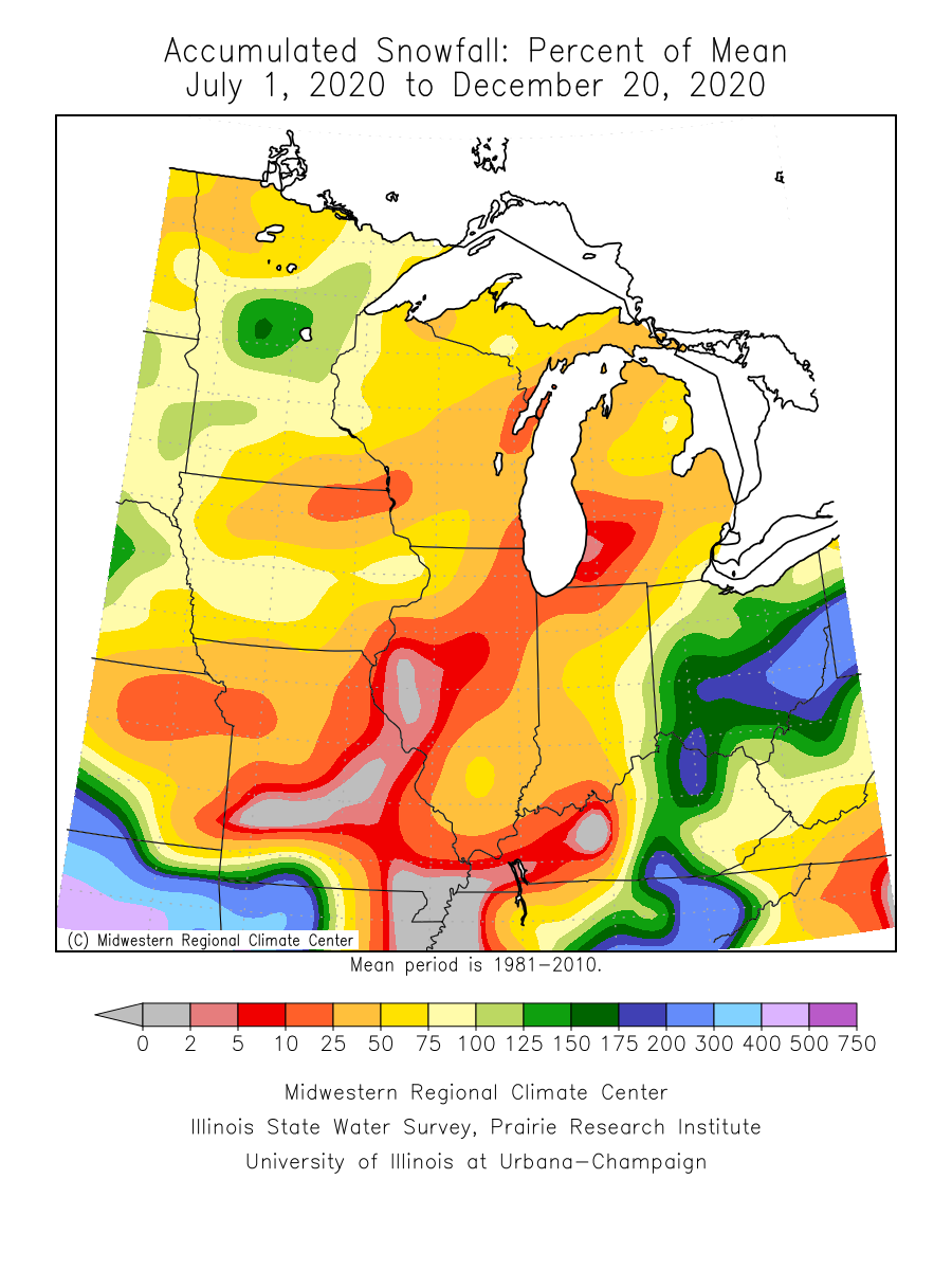 From the graphics above, you can see that there is a snowfall deficit for much of the Midwest. The further NW and SE from Chicago you go the less of a deficit there is. Right smack dab in the middle from essentially Missouri to Michigan is an area of next to no snowfall with the highest deficits maximized in the St Louis to Chicago and up to Milwaukee corridor. Much of the area have received less than an inch of snow to date which equates to under 25% of the normal tally. On top of the lack of snowfall, temperatures in the region have been much warmer than usual which has helped caused a few of the storms that have tracked through the region either to be completely rain or quickly transition to a rain with little accumulation of snow. The images below show that much of the midwest has been 3-6 degrees warmer than normal over the last two months with December especially warmer than usual. By using the Accumulated Winter Season Severity Index which incorporates a variety of factors such as temperature, snowfall and snow depth to create a numeric value for how a winter was, you can determine how harsh or mild a particular winter was. The higher the number the worse the winter and vice versa with a low number with it being a mild winter. From the image below we can see that much of the midwest is in the mild tier with Chicago near a record low value for this date. The image on the right shows the current AWSSI for Chicago and 5 seasons closest to it and how the rest of the season played out. As you can see most ended up in the moderate to mild range which isn't a good sign for those snow lovers out there, including me. 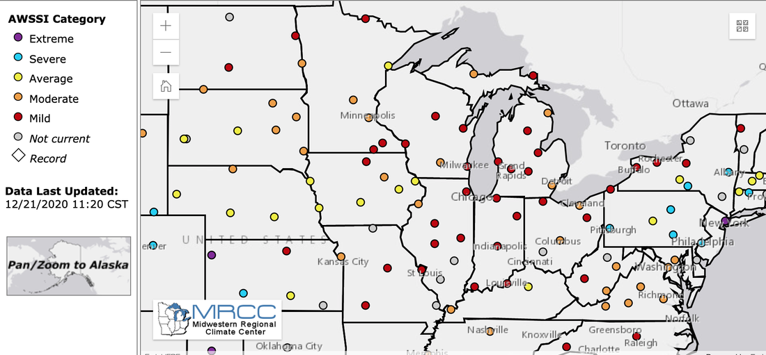 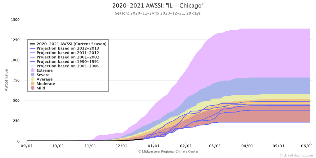 You might be asking yourself what has caused the temperatures to be this warm and by effect have little snowfall. Well, it falls on the upper level pattern we've experienced over the last 8 weeks. This particular pattern has caused much of the cold air to be locked up in Canada while storms would track to the south and east of the Great Lakes. Starting with the jet stream, it was in an unfavourable location for cyclogenesis/storm development over the Midwest. A polar jet well to the north which prohibited cold air from moving south and a subtropical jet well to the south prevented good moisture from reaching too far to the north to help the few storms that did track through the area. On top of that, you had a positive Eastern Pacific Oscillation (+EPO) and positive Pacific-North America Index (+PNA) regime which flooded the continent with mild Pacific air. This in turn helped to moderate the few cold outbursts that occurred earlier in the season. The +PNA and +EPO regime also helped to create a strong Jet Stream over the Pacific and cause an extension of the Jet stream. Due to the orientation of the jet stream in Canada, it helped by way of negative vorticity advection to create a ridge over much of the Upper Plains. This forced the cold air to not only remain in Canada but cause winds to trek over the Mountains which forced them to warm as they descended in the plains warming up the area even more. 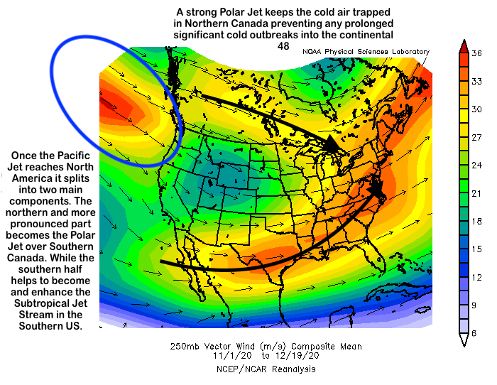 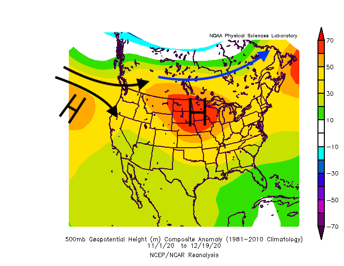 So what is in short term future? Looking ahead to the next two weeks, there are 3 main events that models are picking up on. The first one on Dec 23-24th, the next one on Dec 27-28th and lastly the third will likely occur around the December 30- January 1st time period. The first event, which will happen in the next 36-48 hours will likely be a pattern changer for the time being. While it won't bring accumulating snow, if any at all, it'll bring down the first true cold shot of the year with temperatures struggling to get out of the teens on Christmas Day. The next event won't be a major storm from the looks of it. A shortwave disturbance from Canada will progress E/SE slowly organizing as it goes. From the looks of it, it'll truly become a decent storm when the proper phasing occurs well east of the Great Lakes which is of little importance to Chicago and the Midwest. As of right now it looks with the lack of a true Arctic High to our north, it'll be mild which means that if precipitation does indeed fall, Chicago will be near or at the freezing line so another rain event is possible. The last event before the new year is probably the most enticing out of the three for snowfall prospects. A trough will dig through the Pacific SW and then move slowly to the NE towards the Great Lakes while allowing for cyclogenesis over the central plains. Models vary in the intensity of the digging trough which would decide whether or not the storm maintains it's strength once it moves into the Great Lakes region. Models are all over the place with the storm but confidence is growing of a disruptive storm somewhere in the plains, that being said, the exact location is still unknown as of now. So what does the long term future hold? Looking much further ahead, we can't predict individual events that'll happen but what we can predict is large scale changes to the atmosphere and from that we can create an educated guess on how that will change the weather over a certain location using previous analogs to that event. The event in particular that will likely spice up the weather around Chicago is the potential Sudden Stratospheric Warming (SSW) event that is becoming more and more likely each day. While I won't delve too deeply into the inner workings of a SSW, the general idea is that when the winds at 10mb over the North Pole which usually flow west to east flip directions and flow from east to west in some capacity, while warming the temperature at high altitude, this constitutes a SSW. Since temperature within the Arctic Circle will warm, it'll force the area of really cold temperatures (Polar Vortex) elsewhere in the Northern Hemisphere. For this particular SSW, the effects are still unknown because it's far too early to know where the Polar Vortex (the area of cold temperatures) will end up. If it ends up over North America, it'll cause temperatures to be much below average and potentially bring a much more snowy environment or it could end up over Europe and causing a mild winter over much of North America with little snow for Chicago. The SSW will occur sometime in the next 2-4 weeks but the effects at 10mb won't propagate downward for a while so the effects won't be seen until mid to late January at the earliest. The last major SSW was in January 2019, which caused the temperature in Chicago to go below 0 degrees for 52 straight hours in late January. A lot could change over the next couple of weeks but the general pattern should remain the same. 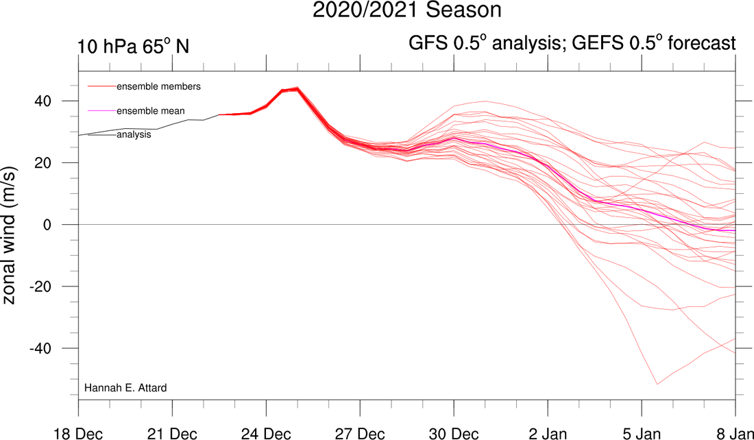 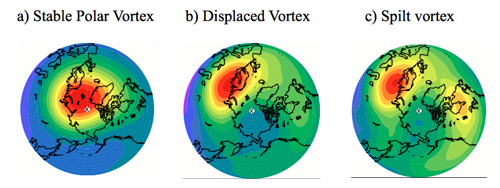
0 Comments
Leave a Reply. |
AuthorHello, my name is Kaylan. I'm currently a sophomore at the University of Wisconsin studying Atmospheric and Oceanic Science. I have had a passion in the weather for as long as I can remember and hope to continue it into the future. Archives
December 2020
Categories |

 RSS Feed
